|
|
Places in Spain -
Extremadura - region
of Spain
|
Extremadura is
a dry,
brown-coloured
land which is
at the same
time, a land
full of water.
Thanks to its
many
reservoirs it
provides a
great deal of
electricity
and water for
irrigation. It
is also a rich
and fertile
land that has
for centuries
supplied much
of Europe with
fresh produce.
The region
covers an area
of 41,602km
square and
consists of
two provinces,
Caceres
and Badajoz.
Extremadura accounts for 8% of the land in Spain. The region
borders
Portugal to
the west,
Andalucia to
the south and
Castilla la
Mancha to the
east. The
total
population,
which has
suffered over
recent years
due to
emigration, is
estimated to
be just over
one million.
The regions
capital is
Merida
which has just
over 51,000
inhabitants.
|
|
|
|

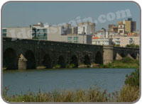
The Roman bridge in Merida
|
| |
|
Extremadura
is a
place of
outstanding
beauty,
surrounded
by nature,
this is
Real Spain
away from
the
costas. It
is only
now being
discovered
and has been
described as the
next best
place to
invest,
with an
average 3
bedroom
villa &
pool for
about the
same price
as an
apartment
in the
coastal
regions.
If it's
Real Spain
and value
for money
you want
then take
a look at
the
amazing
value for
money
prices. |
| |
| Low cost car hire in this part of Spain - Instant quotes, online booking and guaranteed reservations. Access to all the top car hire companies in Spain |
| Brittany Ferries Holidays |
|
|
|
The region
is crossed
from east
to west by
two
important
rivers,
the Tagus
and the
Guadiana.
The Tagus
feeds the
huge
Alcantara
reservoir
which is
the
largest in
western
Europe.
Its size
is such
that it
could
supply
every
inhabitant
in the
world with
500 litres
of water.
Where to visit in Extremadura
Merida
Extremadura's
history is
known to
date back
to
pre-Roman
times when
cave
dwellers
lived in
the area.
Over time
every
civilisation
has left
its mark
in the
region and
this is
best seen
by the
Roman
history to
be found
in
Merida. |
Caceres
The
monumental
city of Caceres has been
appointed
a Heritage
of mankind
city and
contains a
wealth of
historical
monuments.
However
this is
not a city
held back
in time.
Caceres
has
adapted
itself to
the new
influx of
tourists
exploring
the narrow
streets
and
beautiful
squares. The infrastructure in Caceres has improved recently beyond recognition. |

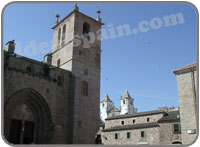
Caceres
|
| |
Trujillo
Trujillo which is
located
just 45km
east of
Cáceres is
a
beautiful
walled
town dated
from the
13th
century
and is one
of the
best
places to
visit in
the
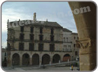
region. The main plaza is surrounded by palaces, churches and fine restaurants. |

Trujillo
|
|
Guadalupe
Guadalupe is a
village of
great
importance
and is
dominated
by the
Gothic
monastery.
A guided
visit
round the
monastery
lasts
about an
hour. The
former
hospital
that
stands
opposite
the
monastery
now houses
the
Parador.Although difficult to get to, Guadalupe is one of the top visited sites in the whole of Spain. |
Plasencia is the
second
most
important
city
within the
Caceres
province.
It has
around
37,000
inhabitants
and stands
along the
River
Jerte. The
city has
two
cathedrals,
one of
which
dates from
the 13th
century.
There are
also
several
palaces
and a
hunting
museum
worthy of
a visit. |
| |
|
| The
surrounding
countryside
is a vast
carpet of
green. As
you make
your way
through
the region
you pass
through
such
places as
the Garden
of la
Vera, the
Valley of
the River
Jerte and
the Sierra
de Gata.
You will
almost
stumble
across
tiny
hamlets
and
villages,
each with
its own
unique
character. |
| |
| By far though,
the jewel of
Extremadura is Merida,
its capital.
It has been a
capital since
Roman times
when it was
the capital of Lusitania. There are
monuments to
see everywhere
but there are
three that you
must see, the
Roman Theatre,
Amphitheatre
and museum. |
| |
The Via de la Plata (Silver Road)
This is a wide, Roman road that runs through the region from top to bottom and is the backbone of Extremadura. The road runs through Caceres, Merida and Zafro, right down to Monasterio. It also forms a way to Santiago de Compostela. If you travel the 300km route you will see the very best of the region and enjoy a real sense of Extremadura. There are several national parks along the route, including Monfrague National Park and Cornalvo National Park. The Monfrague National Park covers and area of over 17,852 hectares and was declared a national park in 1979. The Cornalvo Park covers 10,500 hectares. |
| |
The weather in Extremadura
The weather in Extremadura is influenced by the proximity of the Atlantic Ocean and its location in the middle of the plain. It does not have the typical Mediterranean climate. The rain in Extremadura is frequent in the autumn and spring, with mild temperatures all year round, except for the summer months when temperatures rise and nights become milder.
The rivers of Extremadura
The main rivers that cross Extremadura are the Tajo and the Guadiana. The waters form an important part of the region for agricultural irrigation and hydro-electric power generation. There are numerous reservoirs that generate electricity. La Serena Reservoir is the second largest in Europe. The reservoirs also provide numerous opportunities for fishing and water sports.
Access to Extremadura
The region has an excellent network of roads and the major cities are linked by new roads such as the N-V between Badajoz and Merida and the A-66 which was improved in 2006 to make a better link between Caceres and Merida. The A-66 runs from Banos de Montemayor to Monasterio and follows the Roman road, the Via de la Plata. |
|
|
|
| |
|
| |
|
|
|

